21 Day itinerary in South Africa, Africa
Cape Town to Victoria Falls
The African trip of a lifetime! A learning experience that will change the way you see the world. You will see enough of Africa in 21 days to fall desperately in love.


By Frederick, Justus and Frederick
Overview
Physical Difficulty
Easy
Recommended Age
Everyone
Operated in
English
GUIDANCE
On Some Day Trips
starting point
Cape Town
trip type
Private
trip attributes
Indigenous culture
Nature & Wildlife
 Start
Start
 Night
Night
 End
End
Highlights
Visit Swakopmund, a beach resort and an example of German colonial architecture
Experience the Etosha National Park, home to hundreds of species of mammals, birds and reptiles
Visit the Okavango Delta, the only inland delta in the world
See the magnificent Victoria Falls is one of the seven natural wonders of the world
Itinerary
Mid-range Accommodation
Accommodation Categories
Day 1
Arrive in Cape Town (Saturday)
Cape Town is one of the most picturesque cities in the world, with the majestic Table Mountain providing its central focus. It is the second most populous city in South Africa after Johannesburg and also the legislative capital of South Africa. Colloquially named the Mother City, it is the largest city of the Western Cape Province. Located on the shore of Table Bay, Cape Town, as the oldest urban area in South Africa, was developed by the United East India Company (VOC) as a supply station for Dutch ships sailing to East Africa, India, and the Far East. Today there will be a tour pre-departure briefing this evening at 17:00hrs by your tour leader, who will also collect your local payments, remember to bring American dollars which are as from 2016 to current, as older notes tend to be rejected or fetch a very poor exchange rate.
Accommodation:
- Mid-range Accommodation: 3* Hotel
Day 2
Capetown to Citrusdaal (Sunday) 270km
After breakfast, the tour departs and there will be an included city tour of Capetown where you will visit some attraction sites then by late morning your journey to Citrusdaal town begins whereby you will arrive late in the evening, and after checking into your hotel, there will be an included wine tasting done in your hotel where you will have an opportunity to sample different wines made from the massive wine farms dotting the highlands. The Cederberg is a massive rock wilderness with giant sandstone boulders that have been sculpted by wind and rain into bizarre and artistic shapes. The mountains are located near Clanwilliam, approximately 300 km north of Cape Town, The mountain range is named after the endangered Clan William cedar (Widdringtonia cedarbergensis), which is a tree endemic to the area.
Meals: Breakfast, Lunch, Dinner
Accommodation:
- Mid-range Accommodation: 3* Hotel
Day 3
Citrusdaal to Orange River (Monday) - 463km
Armed with lunch boxes, we travel and have a brief stop at the town of Springbok where we will shop for the next three days then from there we will drive to orange river arriving early evening and immediately getting onto an included canoeing on the Orange river. The Orange River is a river in Southern Africa. It is the longest river within the borders of Lesotho and the Orange River Basin extends extensively into South Africa, Namibia and Botswana to the north. It rises in the Drakensberg mountains in Lesotho, flowing westwards through South Africa to the Atlantic Ocean. We make our way into the more arid regions and upon entering Namibia, we stay at a lodge on the Orange River. Namibia’s southern border river flows quietly and peacefully, and the river valley is hardly affected by tourism. The riverbed is sandy, the water clean and clear. Time free for swimming and relaxing. - Half day canoe safari (included activity). Breakfast, Lunch, and Dinner included.
Meals: Breakfast, Lunch, Dinner
Accommodation:
- Mid-range Accommodation: 3* Hotel
Day 4
Orange River to Fish River Canyon (Tuesday) - 523km
The Fish River Canyon is located in the south of Namibia. It is the largest canyon in Africa, as well as the second most visited tourist attraction in Namibia. It features a gigantic ravine, in total about 100 miles (160 km) long, up to 27 km wide and in places almost 550 meters deep. The Fish River is the longest interior river in Namibia. It cuts deep into the plateau, which is today dry, stony and sparsely covered with hardy drought-resistant plants. The river flows intermittently, usually flooding in late summer; the rest of the year it becomes a chain of long, narrow pools. At the lower end of the Fish River Canyon, the hot springs resort of Ai-Ais is situated. The Fish River Canyon, situated along the lower reaches of the Fish River, is one of the most impressive natural beauties in the southern part of Namibia. With its depth of up to 550 metres, the Fish River Canyon is the second-largest canyon in the world. We make our way to the canyon and in the afternoon watch a spectacular sunset as the sun slips over the canyon’s rim. Overnight at the Canon road house or similar.
Meals: Breakfast, Lunch, Dinner
Accommodation:
- Mid-range Accommodation: Canyon Roadhouse, Gondwana Collection Namibia
Day 5
Fish River Canyon to Sesriem (Wednesday) - 520 km
Today is a long day drive whereby we expect to arrive in the Sesriem area in the evening, we will have lunch boxes, and we will be travelling on dirt road as most of the roads in this region are not tarmacked however they are well maintained and graded most of the time. We arrive in the evening and after checking into our hotel we spent the evening relaxed either in the swimming pool, or at the bar waiting for the following morning to visit the desert. Overnight Sossusvlei Lodge.
Meals: Breakfast, Lunch, Dinner
Accommodation:
- Mid-range Accommodation: Sossusvlei Lodge
Day 6
Full day in the desert
Today after an early breakfast, we drive straight to dune 45, whereby those who have the energy can climb this magnificent piece of wind action before the sun gets hot, then from there we will drive further into the desert to yet another scenic area known as the deadvlei and the magical big daddy sand dune, then afterwards we drive back to our lodge for lunch, then relax till in the evening, when we will visit the Sesriem canyon. The Namib is a coastal desert in Southern Africa. The name Namib is of Khoekhoegowab origin and means "vast place". According to the broadest definition, the Namib stretches for more than 2,000 kilometres (1,200 mi) along the Atlantic coasts of Angola, Namibia, and South Africa, extending southward from the Carunjamba River in Angola, through Namibia and to the Olifants River in Western Cape, South Africa. The Namib's northernmost portion, which extends 450 kilometres (280 mi) from the Angola-Namibia border, is known as Moçâmedes Desert, while its southern portion approaches the neighboring Kalahari Desert. Having endured arid or semi-arid conditions for roughly 55–80 million years, the Namib may be the oldest desert in the world and contains some of the world's driest regions, with only western South America's Atacama Desert to challenge it for age and aridity benchmarks. The parched Namib Desert has endless orange dunes blown into sharp ridges by the sand-shifting wind, and at Sossusvlei they form a gateway into the Namib Desert. We will walk to Sossusvlei, explore Sesriem Canyon, and from the comfort of our lodge outside the national park watch dramatic sunsets over the world’s highest sand dunes. Overnight at Sossusvlei Lodge.
Meals: Breakfast, Lunch, Dinner
Accommodation:
- Mid-range Accommodation: Sossusvlei Lodge
Day 7
Namib desert to Swakopmund - 350km
Today we travel through the rugged mountains, and onto the coastal town of Walvis Bay where we will have some time there watching the flamingos then proceed to Swakopmund arriving early in the evening and after checking in our hotel, we will be driven to the offices of a service provider whereby we will choose the optional activities for the following day.
Meals: Breakfast, Lunch, Dinner
Accommodation:
- Mid-range Accommodation: Hotel Zum Al Kaizer
Day 8
Activities in Swakopmund
Swakopmund (German for "Mouth of the Swakop") is a city on the coast of western Namibia, 352 km (219 mi) west of the Namibian capital Windhoek via the B2 main road. It is the capital of the Erongo administrative district. The town has 44,725 inhabitants and covers 196 square kilometres (76 sq mi) of land. The city is situated in the Namib Desert and is the fourth-largest population centre in Namibia. Today we drop you at the offices of the major players in this town, where you will choose several among the many optional activities available. Optional activities: Sand boarding, skydiving, Ocean canoe safari, Scenic flights (additional cost). Swakopmund is a beach resort and an example of German colonial architecture. It was founded in 1892 as the main harbour for German South West Africa, and a small part of its population is still German-speaking today. Buildings in the city include the Altes Gefängnis prison, designed by Heinrich Bause in 1909. The Woermannhaus, built in 1906 with a prominent tower (Damara tower), is now a public library. Attractions in Swakopmund include a Swakopmund Museum, the National Marine Aquarium, a crystal gallery and spectacular sand dunes near Langstrand south of the Swakop River. Outside the city, the Rossmund Desert Golf Course is one of only five all-grass desert golf courses in the world. Nearby is a farm that offers camel rides to tourists and the Martin Luther steam locomotive, dating from 1896 and abandoned in the desert. Swakopmund lies on the B2 road and the Trans-Namib Railway from Windhoek to Walvis Bay. It is served by Swakopmund Airport and Swakopmund Railway Station. Overnight at Hotel Zum Al Kaizer or Similar.
Meals: Breakfast, Lunch, Dinner
Accommodation:
- Mid-range Accommodation: Hotel Zum Al Kaizer
Day 9
Swakopmund to Damaraland - 230km
After breakfast, we will drive further north, and today we have an included nature walk at Spitzkoppe, a very scenic rock formation whereby we will be held by a local guide, and we will be taken to the ancient rock paintings which teaches us how the early inhabitants of this place used to live, then from there we will proceed to Uis in Brandberg area arriving in time for lunch and after lunch we will have the evening at leisure. Namibia is a land of great contrasts and Damaraland demonstrates this with stark plains, petrified forests and ancient valleys leading to rocky outcrops and the soaring peaks of the Brandberg Massif Mountains. Damaraland was a name given to the north-central part of what later became Namibia, inhabited by the Damaras. It was bounded roughly by Ovamboland in the north, the Namib Desert in the west, the Kalahari Desert in the east, and Windhoek in the south. In the 1970s the name Damaraland was revived for a bantustan in South West Africa (present-day Namibia), intended by the apartheid government to be a self-governing homeland for the Damara people. A centrally administered local government was created in 1980. The bantustan Damaraland was situated on the western edge of the territory that had been known as Damaraland in the 19th century. Damaraland, like other homelands in South West Africa, was abolished in May 1989 at the start of the transition to independence. The name Damaraland predates South African control of Namibia, and was described as "the central portion of German South West Africa" in the Encyclopædia Britannica Eleventh Edition.
Meals: Breakfast, Lunch, Dinner
Day 10
Damaraland to Etosha National Park - 440km
Arriving at our lodge in the evening which is outside the park, this day we have the few remaining hours of the day resting and enjoying the swimming pool among other amenities within the lodge. Etosha National Park is a national park in northwestern Namibia. It was proclaimed a game reserve in March 1907 in Ordinance 88 by the Governor of German South West Africa, Dr. Friedrich von Lindequist. It was designated as Wildschutzgebiet in 1958, and was elevated to the status of a national park in 1967 by an act of parliament of the Republic of South Africa. It spans an area of 22,270 km2 (8,600 sq mi) and gets its name from the large Etosha pan which is almost entirely within the park. The Etosha pan (4,760 km2 (1,840 sq mi)) covers 23% of the total area of the National Park. The park is home to hundreds of species of mammals, birds and reptiles, including several threatened and endangered species such as the black rhinoceros.
Meals: Breakfast, Lunch, Dinner
Accommodation:
- Mid-range Accommodation: Lodge
Day 11
Etosha National Park
The park is located in the Kunene region and shares boundaries with the regions of Oshana, Oshikoto and Otjozondjupa. Once a vast lake fed by the Kunene River, the pan that is Etosha NP dried up thousands of years ago when the river waters chose a new course.
Meals: Breakfast, Lunch, Dinner
Accommodation:
- Mid-range Accommodation: Lodge
Day 12
Etosha to Windhoek - 533km
Windhoek is the capital and largest city of the Republic of Namibia. It is located in central Namibia in the Khomas Highland plateau area, at around 1,700 metres (5,600 ft) above sea level, almost exactly at the country's geographical centre. The population of Windhoek in 2011 was 325,858, growing continually due to an influx from all over Namibia. The city developed at the site of a permanent hot spring known to the indigenous pastoral communities. It developed rapidly after Jonker Afrikaner, Captain of the Orlam, settled here in 1840 and built a stone church for his community. In the decades following, multiple wars and armed hostilities resulted in the neglect and destruction of the new settlement. Windhoek was founded a second time in 1890 by Imperial German Army Major Curt von François, when the territory was colonised by the German Empire. Windhoek is the social, economic, political, and cultural centre of the country. Nearly every Namibian national enterprise, governmental body, educational and cultural institution is headquartered there. Tonight you will visit Joe's beer house for a classy dinner at your cost, let your guide book this early for the group.
Meals: Breakfast, Lunch
Accommodation:
- Mid-range Accommodation: Lodge
Day 13
Windhoek to Kalahari - 526km
The Kalahari Desert is a large semi-arid sandy savanna in Southern Africa extending for 900,000 square kilometres (350,000 sq mi), covering much of Botswana, parts of Namibia and regions of South Africa. Today the drive is long and there is also border crossing It is not to be confused with the Angolan, Namibian and South African Namib coastal desert, whose name is of Khoekhoegowab origin and means "vast place". Crossing into Botswana, we overnight in a lodge in the heart of the Kalahari. We take a nature walk this evening with the local Bushmen to learn fascinating bush skills and in the evening there will be a bush man's dance.
Meals: Breakfast, Lunch, Dinner
Accommodation:
- Mid-range Accommodation: Lodge
Day 14
Kalahari to Maun - 285km
Maun is the fifth-largest town in Botswana. Maun is the "tourism capital" of Botswana and the administrative centre of Ngamiland district. Francistown and Maun there are linked by the A3 highway. It is also the headquarters of numerous safari and air-charter operations who run trips into the Okavango Delta. Arriving on time for lunch we check into our lodge and after lunch spend time on leisure till mid-evening when we are driven to town for some shopping in preparation for the overnight in the delta the following day. Although officially still a village, Maun has developed rapidly from a rural frontier town and has spread along the Thamalakane River. It now has shopping centres, hotels and lodges as well as car hire, although it retains a rural atmosphere and local tribesmen continue to bring their cattle to Maun to sell. The community is distributed along the wide banks of the Thamalakane River where red lechwe can still be seen grazing next to local donkeys, goats and cattle.
Accommodation:
- Mid-range Accommodation: Lodge
Day 15
Okavango Delta
The Okavango Delta (or Okavango Grassland) in Botswana is a swampy inland delta formed where the Okavango River reaches a tectonic trough in the central part of the endorheic basin of the Kalahari. All the water reaching the delta is ultimately evaporated and transpired and does not flow into any sea or ocean. Some floodwaters drain into Lake Ngami. The area was once part of Lake Makgadikgadi, an ancient lake that had mostly dried up by the early Holocene.
Meals: Breakfast, Lunch, Dinner
Accommodation:
- Mid-range Accommodation: Lodge
Day 16
Okavango Delta
The Okavango Delta is the only inland delta in the world: the annual flood of fresh water, spreads over 15000sq km of the Kalahari sand in a maze of lagoons and channels. We journey to the western floodplains of the Okavango Delta to our lodge overlooking a permanent lagoon, where we enjoy a game walk, a mokoro excursion and the amazing birdlife in this pristine wilderness area. The Moremi Game Reserve, a National Park, is on the eastern side of the Delta. The Delta was named as one of the Seven Natural Wonders of Africa, which were officially declared on 11 February 2013 in Arusha, Tanzania. On 22 June 2014, the Okavango Delta became the 1000th site to be officially inscribed on the UNESCO World Heritage List.
Meals: Breakfast, Lunch, Dinner
Accommodation:
- Mid-range Accommodation: Lodge
Day 17
Makgadikgadi Pans
The Makgadikgadi is a salt pan situated in the middle of the dry savanna of north-eastern Botswana, is one of the largest salt flats in the world. The pan is all that remains of the formerly enormous Lake Makgadikgadi, which once covered an area larger than Switzerland, but dried up tens of thousands of years ago. Recent studies of human mitochondrial DNA suggest that modern Homo sapiens first began to evolve in this region some 200,000 years ago, when it was a vast, exceptionally fertile area of lakes, rivers, marshes, woodlands and grasslands especially favorable for habitation by evolving hominins and other mammals. When the rain comes, a dramatic change takes place as the pans come to life with frantically feeding water birds and great herds of zebra, wildebeest and springbok.
Meals: Breakfast, Lunch
Accommodation:
- Mid-range Accommodation: Lodge
Day 18
Chobe National Park
Chobe National Park is Botswana's first national park, and also the most biologically diverse. Located in the north of the country, it is Botswana's third-largest park, after Central Kalahari Game Reserve and Gemsbok National Park, and has one of the greatest concentrations of game in all of Africa. The park is noted for having a population of lions which prey on African elephants, mostly juveniles or subadults but occasionally adults.
Meals: Breakfast, Lunch
Accommodation:
- Mid-range Accommodation: Lodge
Day 19
Chobe National Park
We explore the national park on a morning game drive and spend the rest of the day on the river, enjoying lunch on our cruise boat with spectacular wildlife viewing.
Meals: Breakfast, Lunch
Accommodation:
- Mid-range Accommodation: Lodge
Day 20
Victoria Falls
Magnificent Victoria Falls is one of the seven natural wonders of the world. David Livingstone, the Scottish missionary and explorer, is believed to have been the first European to view Victoria Falls on 16 November 1855, from what is now known as Livingstone Island, one of two land masses in the middle of the river, immediately upstream from the falls near the Zambian shore. Livingstone named his sighting in honour of Queen Victoria of Britain, but the indigenous Lozi language name, Mosi-oa-Tunya—"The Smoke That Thunders"—continues in common usage as well. The World Heritage List officially recognizes both names. Livingstone also cites an older name, Seongo or Chongwe, which means "The Place of the Rainbow" as a result of the constant spray. The nearby national park in Zambia is named Mosi-oa-Tunya, whereas the national park and town on the Zimbabwean shore are both named Victoria Falls. The falls are the centre of a wide range of activities, including white water rafting on the mighty Zambezi, scenic flights or a 111m bungy jump (own expense).
Meals: Breakfast
Accommodation:
- Mid-range Accommodation: Lodge
Day 21
Departure day
Departure for those ending their tour here. The tour ends today after breakfast at 08:00am at the hotel.
Meals: Breakfast
What’s Included
Accommodation
- Lodge
- Canyon Roadhouse, Gondwana Collection Namibia
- Sossusvlei Lodge
- Hotel Zum Al Kaizer
- 3* Hotel
Meals
- Breakfast (19)
- Lunch (17)
- Dinner (13)
Transport
- Transportation as per itinerary
Activities
- As per itinerary
Not Included
- Optional activities
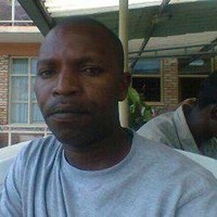
About Frederick
TEAM LEAD
+2 Local experts
Baboo Certified
Hiking
Rafting
Snorkeling/Diving
Visit markets
Meet local people
Indigenous culture
Nature & Wildlife
Food & Culinary
Culture & Heritage
Our team has expertise in the East and Southern Africa region, we have all the know how, net works and contracts with majority of service providers in the region. this makes us have every aspect of the trips that we run at our finger tips.
Travel that Makes a Difference
By choosing to travel with us, you support local communities, wildlife, and the environment. We are dedicated to positively impacting the world through every journey we offer.


Let’s regenerate the planet together
We overcompensate your entire journey’s carbon footprint including flights - for free.
$5,306.00 USD