7 Day itinerary in Spain, Europe
Perdidos High Route: Ordesa and Monte Perdido National Pa...
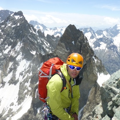
We present six magical days of trekking around the majestic Monte Perdido in the spectacular Ordesa National Park in the heart of the stunning Pyrenees of the Huesca mountain range. The terrain we encounter varies from rough areas to grasslands and forest paths. While extraordinary snow-topped peak... Read More
By Hugo
Overview
Physical Difficulty
Demanding
Recommended Age
Everyone
Operated in
English, Spanish
GUIDANCE
Tour Leader
starting point
Bujaruelo
trip type
Private
trip attributes
Kayak & Canoe
Rafting
Snorkeling/Diving
Hiking
Skiing/Snowboarding
Cycling
Nature & Wildlife
Explorer Trips
 Start
Start
 Night
Night
 End
End
Highlights
Enjoy amazing ladscapes throughout the hike
Cross big ravines where we could see the impressive Cinca waterfall
The path goes along a beautiful forest finishing at the bottom of the impressive Gavarnie Cirque
we will walk towards Valle d’Ossue through a forest
Enjoy amazing ladscapes throughout the hike
Cross big ravines where we could see the impressive Cinca waterfall
The path goes along a beautiful forest finishing at the bottom of the impressive Gavarnie Cirque
we will walk towards Valle d’Ossue through a forest
Itinerary
Mountain Hut
Accommodation Categories
Day 1
Bujarelo Hut on your own
The hut can be reached by car. On this journey, there is no walking and the arrival can be at any time. If you cannot arrive before 7 pm, please let the hut know as the dinner is served at that time.
Meals: Dinner
Day 2
Bujaruelo – Brecha de Ronaldo – Goriz Hut
From Bujaruelo we will cross over the roman bridge and we will go up following the red and white markings that indicate the GR11 to Bujaruelo mountain pass. Here we will follow a sign that leads us to Brecha de Ronaldo Hut. Once we are there, we will descent towards the plateau to access Goriz Hut. Distance: 15,5 km, Ascent: +1.585 m / -723 m
Meals: Breakfast, Dinner
Day 3
Goriz-Añisclo-Pineta
Starting from Goriz, we will follow the path GR11 that ascends gently to Góriz High Col. At this point we leave the GR11 that descents to Añisclo canyon and we follow the markers with a NE direction going along the Faja de las Olas to Añisclo Col. We will go down carefully through a long slope to the Pineta Hut. Distance: 15,5 km, Distance: 12,9 km, Ascent: +602 m / -1.562 m
Meals: Breakfast, Dinner
Day 4
Pineta-Monte Perdido Glacial-Espuguettes
It is a hard stage, but one of the most beautiful of the trek. From Pineta hut (1.240m) we will take a path to go to the back of the corrie. We will cross a bridge over the Cinca River to turn left towards Balcón de Pineta. We will start the stage in a forest that we will soon leave crossing big ravines where we could see the impressive Cinca waterfall with 150m drop. Our path will gain height in a zigzag up to a funnel area, the last stretch before reaching Balcón de Pineta (2.540m). In front of us, we could appreciate the Monte Perdido glacier and its hanging serac. We are on a plateau where the Marboré Lake is. We will border the lake to reach Brecha de Tucarroya (2.666m). Once we get to Brecha de Tucarroya, where there is the not guarded hut with the same name, we will start the descent through the North Gully, with the Cirque of Estaubé beneath our feet, in French territory. We will have to border the back of the cirque and ascent 200m to reach the Col of Hourqette D`Alans(2.430m). We will have the first views of Gavarnie before the descent towards Espuguettes hut (1.760m). Distance: 16,5 km, Ascentl: +1.722 m / -935 m
Meals: Breakfast, Dinner
Day 5
Espuguettes-Circo de Gavarnie-Grange de Holle
We will leave from Espuguesttes Hut towards Gavarnie. After a steep descent, we will find a sign for Gavarnie Cirque to the left. The path goes along a beautiful forest finishing at the bottom of the impressive Gavarnie Cirque. From Hotellerie de Cirque to Gavarnie it is a gentle stroll of about one hour. From the village of Gavarnie to Grange de Holle Hut there is a path not easy to find. We have to follow the signs for the cemetery and once we have passed it takes a path to the right that will lead us to Grange de Holle Hut. Distance: 9,8 km, Ascent: +210 m / -742 m
Meals: Breakfast, Dinner
Day 6
Grange de Holle-Vignemale-Otlettes de Gaube
The path from Grange de Holle Hut is a bit confusing, we will walk towards Valle d’Ossue through a forest. We will pass in front of Cabaña de Lourdes, we will cross Barrage d’Ossue and we will take the slope to reach Bayssellance Hut. We will continue in the path that goes up to Horquette d’Ossue and we will descent to Oulettes Hut. Distance: 20,7 km, Ascent: +1.432 m / -776 m
Meals: Breakfast, Dinner
Day 7
Oulettes Hut - Bujaruelo
We will start from Oulettes towards Los Mulos Col. We will descent from the col following the red and white markers of the HRP. We leave the markers to go to Ara Valley and after a long and gentle slope we will reach again the roman bridge in Bujaruelo and the hut. Distance: 17,9 km, Ascent: +478 m / -1.291 m * The last journey Will finish between 2-4 pm so there is plenty of time for the return trip.
Meals: Breakfast
What’s Included
Meals
- Dinner (6)
- Breakfast (6)
Transport
- Hike throughout the trail with a guide
Activities
- Enjoy enchanting view of the landscapes throughout your hike
Extras
- Welcome package included
- One GPS per group and GPS tracking live
- Gastronomic pack upon arrival at Pineta Hut.
- Ice axe, crampons and all security equipment needed.
- Accident and rescue insurance
Not Included
- International Flights
- Transfer to meeting point
- Meals not specified as included
- Tips for Guides
Travel that Makes a Difference
By choosing to travel with us, you support local communities, wildlife, and the environment. We are dedicated to positively impacting the world through every journey we offer.


Let’s regenerate the planet together
We overcompensate your entire journey’s carbon footprint including flights - for free.
Ask for Quote